Hazardous Weather Outlook
National Weather Service Midland/Odessa TX
135 PM CDT Wed Jul 26 2017
Guadalupe Mountains of Eddy County-Eddy County Plains-
Northern Lea County-Central Lea County-Southern Lea County-Gaines-
Dawson-Borden-Scurry-Andrews-Martin-Howard-Mitchell-
Van Horn and Highway 54 Corridor-Reeves County and Upper Trans Pecos-
Loving-Winkler-Ector-Midland-Glasscock-Ward-Crane-Upton-Reagan-
Davis/Apache Mountains Area-Pecos-Presidio Valley-Marfa Plateau-
Big Bend Area-Terrell-Guadalupe Mountains-
This hazardous weather outlook is for portions of southeast New
Mexico, southwest Texas and western Texas.
.DAY ONE…THIS AFTERNOON AND TONIGHT
Thunderstorms are possible over the higher terrain this afternoon
and evening. These storms could produce gusty wind and occasional
lighting.
.DAYS TWO THROUGH SEVEN…THURSDAY THROUGH TUESDAY
Flash Flood Statement
National Weather Service Las Vegas NV
434 PM PDT WED JUL 26 2017
…THE FLASH FLOOD WARNING REMAINS IN EFFECT UNTIL 645 PM PDT FOR
CENTRAL LINCOLN COUNTY…
At 430 PM PDT, Doppler radar and automated rain gauges indicated
thunderstorms were producing over one inch of rain per hour across
parts of the area between Rachel and the North Pahroc Range in
central Lincoln County. The thunderstorms were moving to the
northeast around 10 mph.
Some locations that will experience flooding include…
State Route 375 just west of Crystal Springs toward Hancock Summit,
State Route 318 north of Hiko.
PRECAUTIONARY/PREPAREDNESS ACTIONS…
In hilly terrain there are hundreds of low water crossings which are
potentially dangerous in heavy rain. Do not attempt to cross flooded
roads. Find an alternate route.
Please report flooding to your local law enforcement agency when you
can do so safely.
………………………………………………………………………………………………………………………….
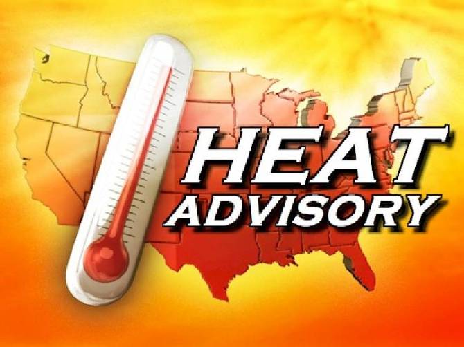
Heat Advisory
URGENT - WEATHER MESSAGE
National Weather Service Little Rock AR
146 PM CDT Wed Jul 26 2017

ARZ016-021-022-025-030>034-037>047-052>057-062>069-270400-
/O.CON.KLZK.HT.Y.0004.000000T0000Z-170728T0100Z/
Independence-Johnson-Pope-Jackson-Logan-Conway-Faulkner-White-
Woodruff-Scott-Yell-Perry-Polk-Montgomery-Garland-Saline-Pulaski-
Lonoke-Prairie-Monroe-Pike-Clark-Hot Spring-Grant-Jefferson-
Arkansas-Dallas-Cleveland-Lincoln-Desha-Ouachita-Calhoun-Bradley-
Drew-
Including the cities of Batesville, Clarksville, Russellville,
Newport, Booneville, Paris, Morrilton, Conway, Searcy, Beebe,
Augusta, McCrory, Cotton Plant, Waldron, Dardanelle, Danville,
Ola, Perryville, Mena, Mount Ida, Norman, Hot Springs, Benton,
Bryant, Little Rock, North Little Rock, Cabot, Lonoke, Des Arc,
Hazen, Brinkley, Clarendon, Glenwood, Murfreesboro, Arkadelphia,
Malvern, Sheridan, Pine Bluff, Stuttgart, De Witt, Fordyce,
Kingsland, Rison, Star City, Gould, Dumas, Mcgehee, Camden,
Hampton, Thornton, Warren, and Monticello
146 PM CDT Wed Jul 26 2017

...HEAT ADVISORY REMAINS IN EFFECT UNTIL 8 PM CDT THURSDAY...

* EVENT: Heat index values will rise to around or just over 105
  degrees.

* AREAS AFFECTED: The Arkansas River Valley and the northeastern
  delta counties...including metropolitan Little Rock.

* TIMING: Expect the heat index values to reach around 105, this
  afternoon, as well as Thursday afternoon.

* IMPACTS: Oppressive conditions may lead to heat stroke and
  dehydration for people outdoors.

PRECAUTIONARY/PREPAREDNESS ACTIONS...

A Heat Advisory means that a period of hot temperatures is
expected. The combination of hot temperatures and high humidity
will combine to create a situation in which heat illnesses are
possible. Drink plenty of fluids...stay in an air-conditioned
room...stay out of the sun...and check up on relatives and
neighbors.

Take extra precautions...if you work or spend time outside. When
possible...reschedule strenuous activities to early morning or
evening. Know the signs and symptoms of heat exhaustion and heat
stroke. Wear light weight and loose fitting clothing when
possible and drink plenty of water.

To reduce risk during outdoor work...the occupational safety and
health administration recommends scheduling frequent rest breaks
in shaded or air conditioned environments. Anyone overcome by
heat should be moved to a cool and shaded location. Heat stroke
is an emergency...call 9 1 1.

&&

$$
Hazardous Weather Outlook
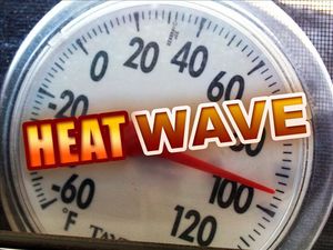
Hazardous Weather Outlook
National Weather Service Little Rock AR
642 AM CDT Wed Jul 26 2017

ARZ003>007-012>016-021>025-030>034-037>047-052>057-062>069-271145-
Boone-Marion-Baxter-Fulton-Sharp-Newton-Searcy-Stone-Izard-
Independence-Johnson-Pope-Van Buren-Cleburne-Jackson-Logan-Conway-
Faulkner-White-Woodruff-Scott-Yell-Perry-Polk-Montgomery-Garland-
Saline-Pulaski-Lonoke-Prairie-Monroe-Pike-Clark-Hot Spring-Grant-
Jefferson-Arkansas-Dallas-Cleveland-Lincoln-Desha-Ouachita-
Calhoun-Bradley-Drew-
642 AM CDT Wed Jul 26 2017

This Hazardous Weather Outlook is for a Large Part of Arkansas.

.DAY ONE...Today and Tonight

Hot and humid conditions continue today, with highs in the upper
90s and heat index values of around 105 degrees expected for much
of Arkansas. Heat advisories have been issued to account for this.

.DAYS TWO THROUGH SEVEN...Thursday Through Tuesday

Thursday will also be hot and humid, with highs once again
reaching into the upper 90s for many locations and afternoon heat
index values of around 105 degrees for several hours.

Thursday night into Friday, a cold front and accompanying showers
and thunderstorms will move into the state. While widespread
severe storms are not expected, a few strong storms with strong
winds could occur.
Heat Advisory
URGENT - WEATHER MESSAGE
National Weather Service Little Rock AR
146 PM CDT Wed Jul 26 2017

ARZ016-021-022-025-030>034-037>047-052>057-062>069-270400-
/O.CON.KLZK.HT.Y.0004.000000T0000Z-170728T0100Z/
Independence-Johnson-Pope-Jackson-Logan-Conway-Faulkner-White-
Woodruff-Scott-Yell-Perry-Polk-Montgomery-Garland-Saline-Pulaski-
Lonoke-Prairie-Monroe-Pike-Clark-Hot Spring-Grant-Jefferson-
Arkansas-Dallas-Cleveland-Lincoln-Desha-Ouachita-Calhoun-Bradley-
Drew-
Including the cities of Batesville, Clarksville, Russellville,
Newport, Booneville, Paris, Morrilton, Conway, Searcy, Beebe,
Augusta, McCrory, Cotton Plant, Waldron, Dardanelle, Danville,
Ola, Perryville, Mena, Mount Ida, Norman, Hot Springs, Benton,
Bryant, Little Rock, North Little Rock, Cabot, Lonoke, Des Arc,
Hazen, Brinkley, Clarendon, Glenwood, Murfreesboro, Arkadelphia,
Malvern, Sheridan, Pine Bluff, Stuttgart, De Witt, Fordyce,
Kingsland, Rison, Star City, Gould, Dumas, Mcgehee, Camden,
Hampton, Thornton, Warren, and Monticello
146 PM CDT Wed Jul 26 2017

...HEAT ADVISORY REMAINS IN EFFECT UNTIL 8 PM CDT THURSDAY...

* EVENT: Heat index values will rise to around or just over 105
  degrees.

* AREAS AFFECTED: The Arkansas River Valley and the northeastern
  delta counties...including metropolitan Little Rock.

* TIMING: Expect the heat index values to reach around 105, this
  afternoon, as well as Thursday afternoon.

* IMPACTS: Oppressive conditions may lead to heat stroke and
  dehydration for people outdoors.

PRECAUTIONARY/PREPAREDNESS ACTIONS...

A Heat Advisory means that a period of hot temperatures is
expected. The combination of hot temperatures and high humidity
will combine to create a situation in which heat illnesses are
possible. Drink plenty of fluids...stay in an air-conditioned
room...stay out of the sun...and check up on relatives and
neighbors.

Take extra precautions...if you work or spend time outside. When
possible...reschedule strenuous activities to early morning or
evening. Know the signs and symptoms of heat exhaustion and heat
stroke. Wear light weight and loose fitting clothing when
possible and drink plenty of water.

To reduce risk during outdoor work...the occupational safety and
health administration recommends scheduling frequent rest breaks
in shaded or air conditioned environments. Anyone overcome by
heat should be moved to a cool and shaded location. Heat stroke
is an emergency...call 9 1 1.

&&

$$
Hazardous Weather Outlook
Hazardous Weather Outlook
National Weather Service Little Rock AR
642 AM CDT Wed Jul 26 2017

ARZ003>007-012>016-021>025-030>034-037>047-052>057-062>069-271145-
Boone-Marion-Baxter-Fulton-Sharp-Newton-Searcy-Stone-Izard-
Independence-Johnson-Pope-Van Buren-Cleburne-Jackson-Logan-Conway-
Faulkner-White-Woodruff-Scott-Yell-Perry-Polk-Montgomery-Garland-
Saline-Pulaski-Lonoke-Prairie-Monroe-Pike-Clark-Hot Spring-Grant-
Jefferson-Arkansas-Dallas-Cleveland-Lincoln-Desha-Ouachita-
Calhoun-Bradley-Drew-
642 AM CDT Wed Jul 26 2017

This Hazardous Weather Outlook is for a Large Part of Arkansas.

.DAY ONE...Today and Tonight

Hot and humid conditions continue today, with highs in the upper
90s and heat index values of around 105 degrees expected for much
of Arkansas. Heat advisories have been issued to account for this.

.DAYS TWO THROUGH SEVEN...Thursday Through Tuesday

Thursday will also be hot and humid, with highs once again
reaching into the upper 90s for many locations and afternoon heat
index values of around 105 degrees for several hours.

Thursday night into Friday, a cold front and accompanying showers
and thunderstorms will move into the state. While widespread
severe storms are not expected, a few strong storms with strong
winds could occur.
